 Scene
Scene


 1st Slide
 Branching Point
 Module: Modelle des Kosmos: Modelle der Erde
 Sequence: 0.0. START
 Branching Point: Models of the Earth
 Slide: Ptolemaic World Map
Medieval maps of the world often subordinate geography to the Christian worldview. Jerusalem constitutes the center of a disc surrounded by water, which is held by Jesus’ outstretched arms. Over one thousand legends make the Ebstorf world map a chronicle of the world.
Modelle des Kosmos: Modelle der Erde


Ebstorf World Map
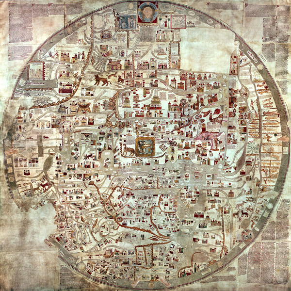
The Ebstorf World Map originates from the thirteenth century. It was probably created in the Lueneburg moor land in the monastery of Ebstorf (on the map
Ebbekestorp, founded in the eleventh century). The map was destroyed during World War II. It was reconstructed based on photos.
[ Sitemap ]
[ info ] This website was created by the MPI for the History of Science.