Anwendungen
 Scene
Scene


 1st Slide
 Branching Point
 Module: Anwendungen
 Sequence: lev0_start
 Branching Point: Applications. The practical heritage
 Slide: Lasers in the industrial fabrication

Classical navigation - sextant
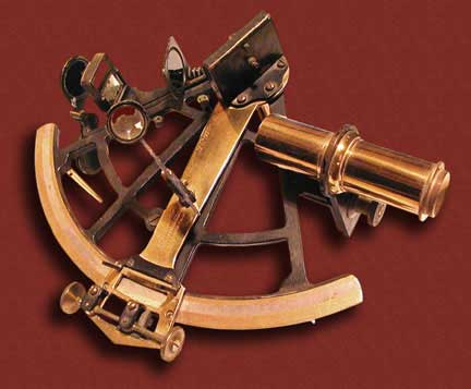
Navigation rests substantially on determining positions. The sea surface is almost two-dimensional; a position is thus given by two coordinates, so that two independent measurements are needed.
At sea distances are traditionally measured using the sextant, essentially a goniometer. If the height of a marked object on shore is known, for example from the sea chart, the height angle is used to determine ones own distance from the object.
The traditional astronomical navigation at sea, for which the sextant is also used, reaches an accuracy of a few kilometres. It is thus feasible for a coarse assessment of position only.
[ Sitemap ]
[ info ] This website was created by the MPI for the History of Science.